Città
Fertőszentmiklós
Győr-Moson-Sopron · Ungheria
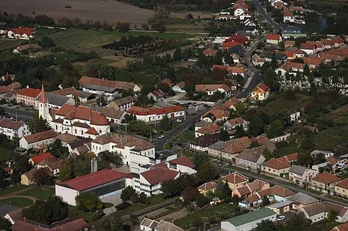
Fertőszentmiklós: i segni sono ancora troppo pochi per mostrare i numeri senza far riconoscere nessuno.
Fertőszentmiklós in breve
- Paese
- Ungheria
- Regione
- Győr-Moson-Sopron
- Superficie
- 38 km2
- Abitanti
- 3933 al 2025
- Coordinate
- 47.590, 16.875
Fertőszentmiklós: posti da vedere nei dintorni
- Parco nazionale Neusiedler See-Seewinkel area protetta · 17 km
- Fertőrákos mithraeum sito archeologico · 24 km
- Cattedrale di Eisenstadt chiesa · 39 km
- Castello Esterházy castello · 39 km
- Lockenhaus Castle castello · 40 km
- Geschriebenstein montagna · 42 km
- Castello di Forchtenstein castello · 43 km
- Cathedral of the Visitation chiesa · 44 km
Győr-Moson-Sopron: altre città
- Győr 58 km
- Sopron 24 km
- Mosonmagyaróvár 43 km
- Csorna 28 km
- Kapuvár 12 km
- Jánossomorja 29 km
- Rajka 51 km
- Győrújbarát 58 km
- Tét 48 km
- Pannonhalma 66 km
- Nyúl 61 km
- Hegyeshalom 42 km